How Easily to Make an Isochrone (For Free!)
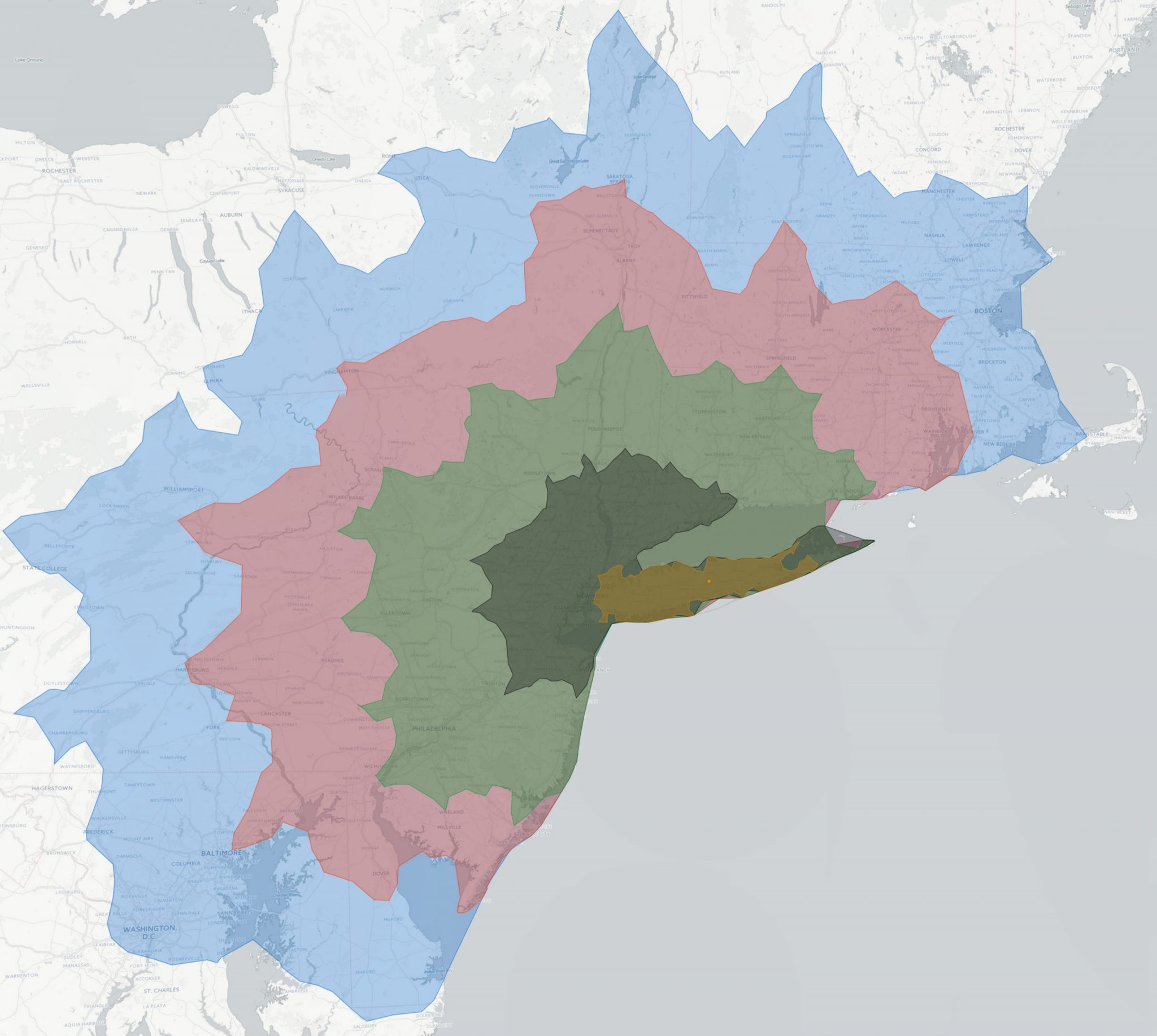
For those who have never heard of one, an Isochrone is an awesome map that shows you how far you can travel in a given amount of time. The above image, for example, shows how far I could travel (by car doing the speed limit) from my home town in hour increments.
I had seen websites that showed you how far you could travel by public transportation (here and here) but they were limited to certain cities and, worse, limited by how far you could travel.
Most isochrone maps either require a ton of coding or they’re simply not free. After some digging, I found this website: https://iso4app.net/demo.jsp Just change the isoline from isodistance to isochrone and then click any point and it will show you an isochrone! However, it’s limited to a travel time of 10 minutes unless you follow the following steps:
- Go here: https://iso4app.net/#api and request an API key
- Follow the instructions on the email to obtain the API key (log into the site after activating)
- Go to: https://iso4app.net/demo.jsp and paste the API key in the designated box.
- That’s it! The API key you get is only good for 1000 lines and you can only use it for the month before you’d have to pay.
Now you can adjust the settings to any distance! If you want it to look like mine (with multiple lines), just uncheck remove previous isoline.